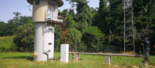
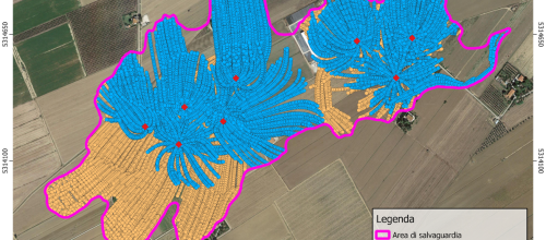
Vecchiano (PI)
ItalyPerimetrazione dell’area di salvaguardia del campo pozzi denominato “Filettole” (2022)
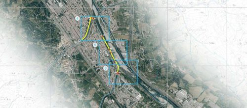
Autostrada A26
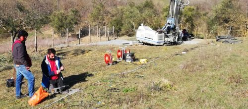
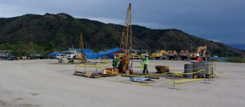
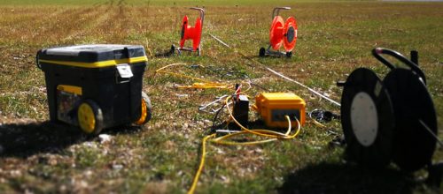
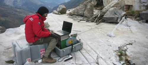
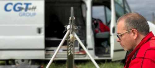
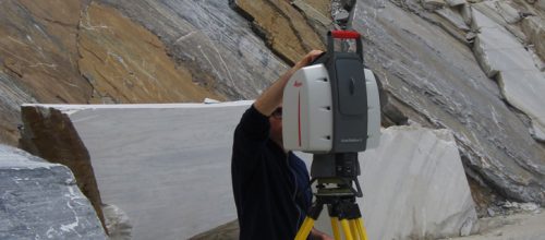
ItalyIndagini geofisiche (prospezioni sismiche) in autostrada presso Viadotto Strona (2022)
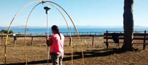
Trino Vercellese (VC)
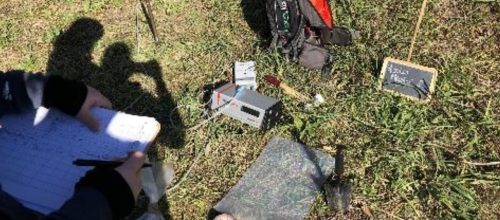
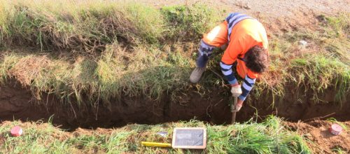
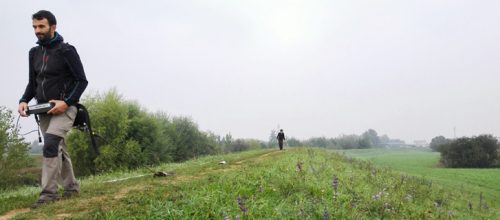
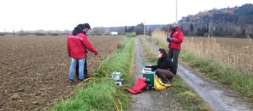
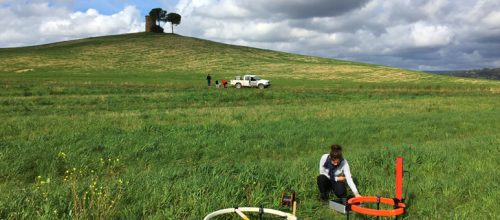
ItalySorveglianza archeologica Trino Vercellese (2022)

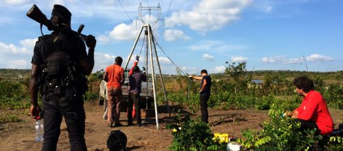
Betlemme
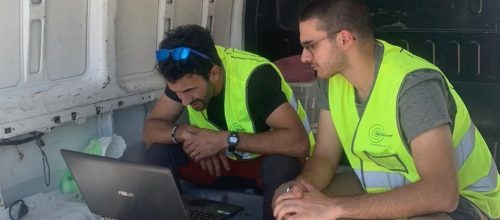
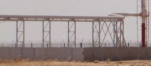
PalestinaProgetto Bethlehem Green City: Contribuire a rendere più efficiente il sistema di raccolta dei rifiuti solidi urbani in Palestina (2022)

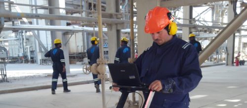
Assiut
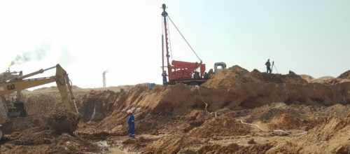
EgittoSupervisione cantiere Assiut per aree destinate a trincea definitiva (2022)
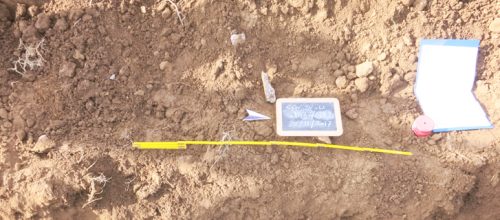
Terracina (LT)
ItaliaIndagini finalizzate alla Verifica preventiva d’interesse archeologico VIArch per EGP (2022)
Cavriglia (AR)
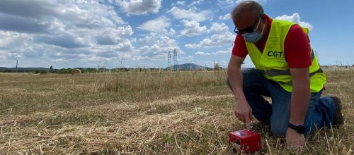
ItaliaProva Down-hole presso frana Mesina in area ENEL (2022)
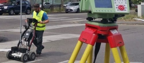
Forte dei Marmi (LU)
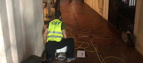
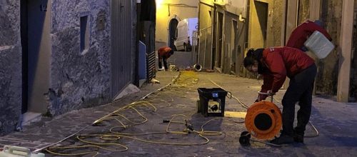
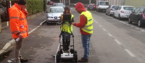
ItaliaIndagini geofisiche (prospezioni elettromagnetiche GPR) finalizzate all’individuazione di sottoservizi (2022)
Autostrada A1, tra Incisa e Firenze Sud
ItaliaIndagini geofisiche (prospezioni sismiche) in autostrada alle uscite di Incisa-Reggello e Firenze Sud (2022)
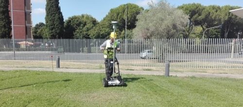
Rieti
ItaliaIndagini geofisiche (prospezioni elettromagnetiche GPR) finalizzate all’individuazione di sottoservizi (2022)
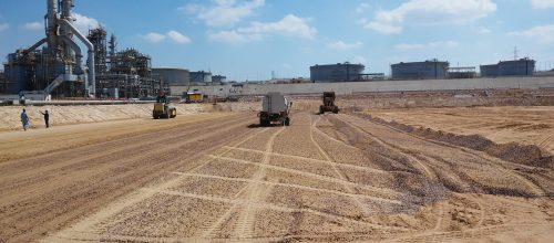
Val di Cornia (LI)
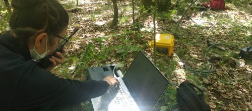
ItaliaModello data-driven dinamico dell’area della Val di Cornia ai fini dell’ottimizzazione della risorsa idrica sotterranea (2022)
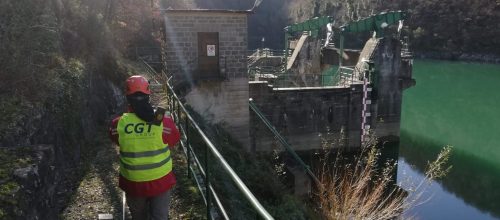
Barberino di Mugello (FI)
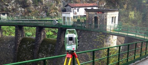
ItaliaIndagini geofisiche presso le dighe Bilancino e Migneto (2022)
Friuli Venezia Giulia
ItaliaIndagini finalizzate alla Verifica preventiva d’interesse archeologico VIArch per linea elettrica TERNA in Friuli VG (2022)
Genova
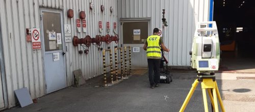
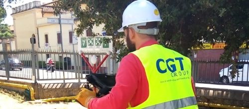
ItaliaRilievo topografico punti ambientali Deposito ENI Genova Porto (2022)
Marano Vicentino (VI)
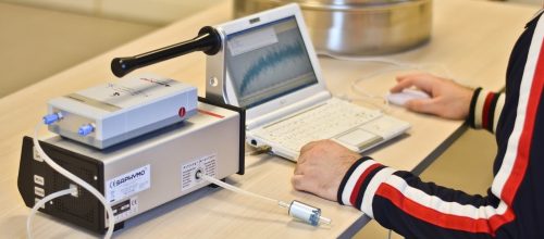
ItaliaMonitoraggio ambientale di gas Radon (2022)
Rovereto (TN)
ItaliaMonitoraggio ambientale di gas Radon (2022)
Isera (TN)
ItaliaMisure di radioattività su materiali da costruzione (2022)
Mar Adriatico
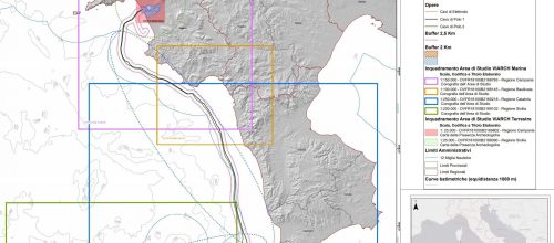
ItaliaIndagini finalizzate alla Verifica preventiva d’interesse archeologico VIArch per tracciato Adriatic Link in ambito terrestre (2021)
Laguna di Caleri (FE)
ItaliaServizio di acquisizione aerea di onde elettromagnetiche nella laguna di Caleri (delta del Po - Ferrara) RS prof. Mistri (2021)
Mar Adriatico
ItaliaIndagini finalizzate alla Verifica preventiva d’interesse archeologico VIArch per tracciato Adriatic Link in ambito marino (2021)
Genova
ItaliaIndagini georadar impianto industriale ENI di Genova Pegli (2021)
Pisa
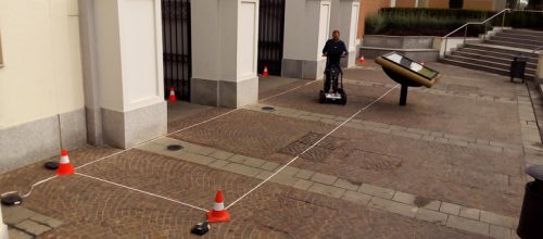
ItaliaIndagine georadar per serbatoi fantasma ex PV carburante in Piazza Guerrazzi (2021)
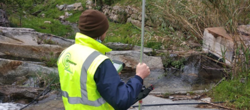
Val di Cecina (LI e PI)
ItaliaRedazione di relazioni tecniche acque di restituzione di impianti di potabilizzazione (2021)
Pomarance (PI)
ItaliaIndagini finalizzate alla Verifica preventiva d’interesse archeologico VIArch concessioni geotermiche Larderello, Travale, Lustignano e Canneto (PI e SI) (2021)
Bornasco, Pechiera Borromeo e Settimo Milanese (MI)
ItaliaIndagini finalizzate alla Verifica preventiva d’interesse archeologico VIArch (2021)
Longarone (BL)
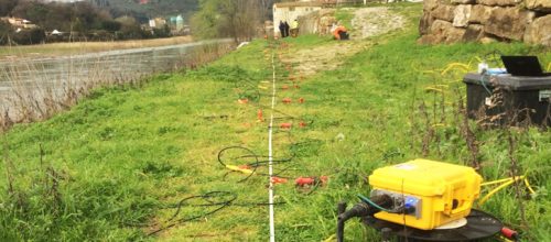
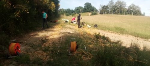
ItaliaIndagine sismica a riflessione (2021)
Cortina d'Ampezzo (BL)
ItaliaIndagini geofisiche (sismica a rifrazione e a riflessione) (2021)
Cortina d'Ampezzo (BL)
ItaliaIndagini georadar per applicazioni archeologiche (2021)
Arezzo
ItaliaAnalisi gradiometriche e georadar per lavori acquedottistici di collegamento alla depurazione (2021)
Rocca San Felice (AV)
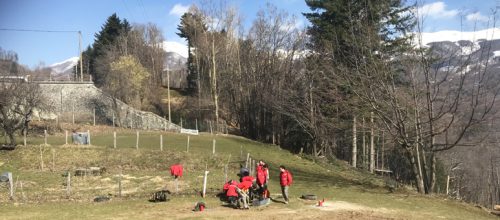
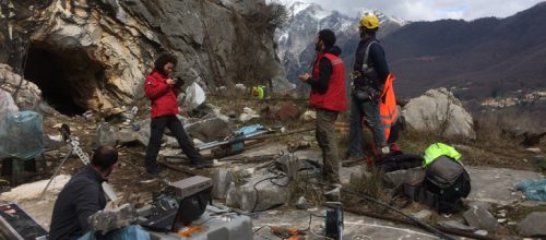
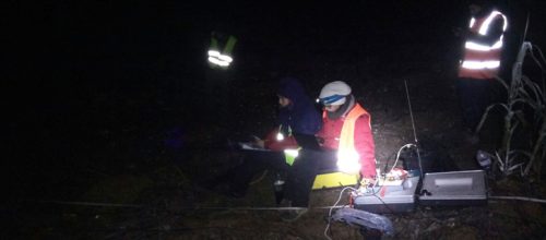
ItaliaSupporto tecnico per indagini geofisiche presso le Mefite di Rocca San Felice (2021)
Vicenza
ItaliaIndagini sismiche per la Linea ferroviaria AV/AC Verona-Padova IRICAV (2021)
Firenze
ItaliaIndagine GPR presso Villino Panerai in Firenze (2021)
Arezzo
ItaliaIndagine GPR per progetto scarichi liberi nelle loc. Policiano, Rigutino, Vitiano (2021)
Cremona
ItaliaIndagine georadar per la ricerca di sottoservizi (2021)
Vagli e Lizzano (LU)
ItaliaIndagini sismiche per studio dei dissesti franosi in loc. Vagli e Lizzano (2021)
Montieri (GR)
ItaliaIndagini finalizzate alla Verifica preventiva d’interesse archeologico VIArch per pozzi geotermici - postazioni “Montieri 1” e “Montieri 2 (2021)

Bitti, Lula e Onanì (NU)
ItaliaLog geofisico multiparametrico in Sardegna presso Bitti, Lula e Onanì (2021)
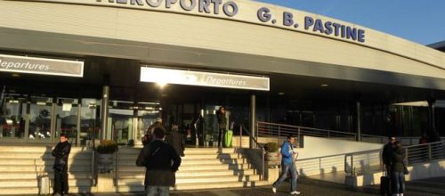
Roma
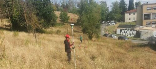
ItaliaAssistenza agli scavi per indagini archeologiche per la realizzazione per le nuove No Entry e Stop Bar c/o l'Aeroporto G.B. Pastine di Ciampino (2021-2022)
Mar Tirreno occidentale
ItaliaVerifica preventiva dell'interesse per progetto Tyrrhenian Link West nel Mar Tirreno tra Sicilia e Sardegna (2021)
Symple lectures
ItaliaLezioni tematiche in lingua inglese per SYMPLE Scuola di Modellistica Idrogeologica (2021)
Marciana e Campo Nell'Elba (LI), Pomarance e Santa Luce (PI)
ItaliaPerimetrazione dell’area di salvaguardia delle captazioni superficiali in sei acque fluenti (2021)
Radicondoli (SI)
ItaliaPerimetrazione dell’area di salvaguardia delle captazioni superficiali nel Lago Madonna Olli (2021)
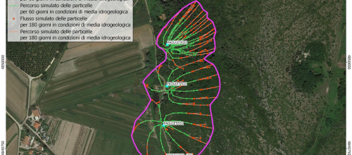
Campiglia Marittima (LI)
ItaliaPerimetrazione dell’area di salvaguardia del campo pozzi denominato “Macchialta” (2021-2022)
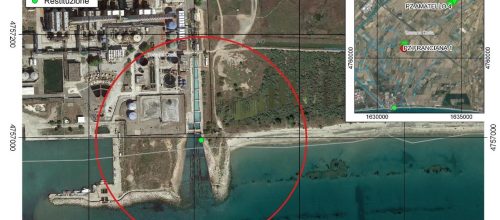
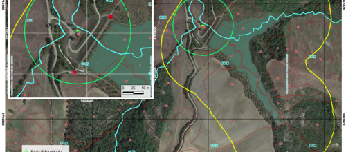
Vecchiano (PI)
ItaliaPerimetrazione dell’area di salvaguardia del campo pozzi denominato “Paduletto” (2021-2022)
Assiut
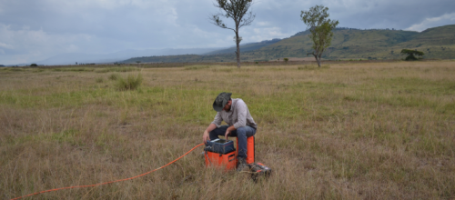
EgittoModellazione numerica del flusso idrico sotterraneo (2021)
Marciana Marina (LI)
ItaliaLog geofisico multiparametrico (2021)
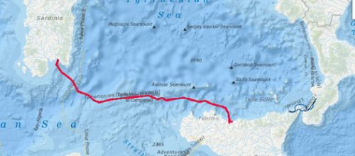
Mar Tirreno orientale
ItaliaVerifica preventiva dell'interesse per progetto Tyrrhenian Link Est nel Mar Tirreno tra Campania e Sicilia (2021)
Massa
ItaliaStudio geochimico-isotipico (2021)
Telese (BN)
ItaliaVerifica preventiva dell'interesse archeologico (2021)
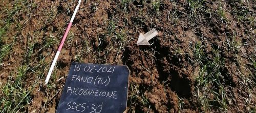
Fano (PU)
ItaliaVerifica preventiva dell'interesse archeologico (2021)
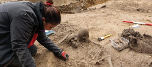
Fiumicino
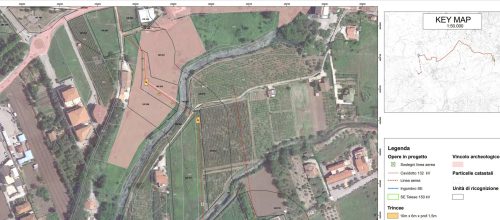
ItaliaIndagini archeologiche durante attività di movimentazione terra (2021-2022)
Camerata (FI)
ItaliaIndagine GPR per la ricerca di cavità antropiche (2021)
Rignano sull'Arno (FI)
ItaliaIndagine sismica (rifrazione + DH) e Georadar (2021)
Firenze Nord
ItaliaIIndagine GPR per la ricerca di sottoservizi presso svincolo autostradale (2020-2021)
Assiut
EgittoSupervisione indagini geofisiche e geognostiche (2020-2021)
Costa Apuo-Versiliese (LU)
ItaliaProgetto di ricerca - risorse idriche della costa apuo-versiliese (2020-2021-2022)
Isola d'Arbia (SI)
ItaliaSupervisione indagini ambientali (2020-2021)
Brica (LU)
ItaliaIndagini geofisiche a supporto dello studio dei dissesti (2020)
Milano
ItaliaIndividuazione dei sottoservizi con prospezione Georadar in area industriale (2020)
Puretta (PI)
ItaliaIndagine geofisica integrata per il controllo della continuità di un setto impermeabile (2020)
Cavriglia (AR)
ItaliaIndagini geofisiche in ambito archeologico presso il Castello di Montedomenichi (2020)

Pomaia (PI)
ItaliaIndagini geofisiche integrate finalizzate all’individuazione di cavità sotterranee (2020)
Pisa
ItaliaIndagine GPR per l'individuazione di sottoservizi in area industriale (2020)
Milano
ItaliaIndagine geoelettriche 3D e GPR finalizzate all’individuazione di strutture antropiche (2020)
Grosseto
ItaliaApplicazione di tecnologie idrogeofisiche finalizzate alla valutazione delle caratteristiche idrogeologiche in chiave agronomica (2020)
Polizzi Generosa (PA)
ItaliaVerifica preventiva dell’interesse archeologico presso area destinata a futuro impianto eolico (2020)
Castelsantangelo su Nera (MC)
ItaliaProspezioni sismiche e geoelettriche per lo studio di stabilità di versante in roccia (2020)
Terranuova Bracciolini (AR)
ItalyGeoradar survey to support the design of the road variant at SRT n.69 to the A1 highway exit (2020)
Camaiore (LU)
ItalyMicrogravimetric surveys to support II level seismic microzonation (2020)
Volterra (PI)
ItalyGeophysical survey (Seismic refraction and Down-hole) to support the design of the new tank (2020)
Sesto F.no (FI)
ItalyGPR survey for the search of underground services at Eli Lilly Italia (2020)
Ferrara
ItalyEnvironmental monitoring of radon gas (2020)
Maltignano (AP)
ItalyGeophysical investigation for cavity research in urban environment with geoelectric method (2D and 3D) and GPR method (2019-2020)
Trezzano sul Naviglio (MI)
ItalyGPR survey for the search for underground utilities (2020)
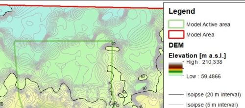
INFN (Ferrara)
ItalyGeophysical characterization of the JUNO experiment site (Jiangmen Underground Neutrino Observatory - China), 2019-2020
Veneto, Emilia Romagna, Toscana
ItalyGeophysical surveys at ENEL Green Power dams (2019-2020)
Alexandria
EgyptSite supervision of geognostic activity (2019-2020)
Milano, Brescia
ItalyGPR survey for the search for underground utilities (2019)
Sesto F.no (FI)
ItalyGPR survey for the search for underground utilities at Eli Lilly Italia (2019)

Figline V.no - Firenze
ItalyGPR survey for the search for underground utilities (2019)
Firenze
Italy2019, GPR investigations for the underground services detection
Iglesias – Sud Sardegna
Italy2019, Geophysical approach by resistivity and chargeability method aimed at environment studies support
Bolognano – Pescara
Italy2019, Geophysical surveys (microgravimetrics and geoelectrics methods) aimed at identifying underground cavities
Manfredonia – Foggia
Italy2019, Microgravimetrics surveys for underground research cavities - SS.89 "Garganica"
Loc. Biancaiole (SI)
Italy2019, Reflection seismic, magnetotellurics and borehole geophysical log for water research
Santa Barbara – Cavrliglia (AR)
Italy2018-2019, Geoelectrics and sonic cross-hole surveys for slope stability study
Seravezza – Lucca
Italy2018-2019, Gpr survey to locate the contact between the altered layer and bedrock
Albiano Magra (MS), Massarosa (LU) e Castelnuovo di G.na (LU)
Italy2018-2019, Environmental characterizations and hydrogeological studies aimed at delimiting the protection area for water wells
Valdarno Superiore (AR)
Italy2018, Archaeological Study - "Arno Bike-lane" - San Giovanni Valdarno-Levane itinerary
Chianciano (SI)
ItalyGeophysical surveys to support the geotechnical study at the "Carpineto" farm
Castel Campagnano (CE)
Italy2018, Geophysical surveys for slope stability (collapse of the municipal cemetery)
Sesto F.no (FI)
Italy2018, Georadar survey to locate the underground services at the new Eli Lilly building
Monte Calamita – Isola d’Elba (LI)
Italy2018, Hydrogeophysical study of the southern portion of Monte Calamita to evaluate the underground water resource
Kuwait City
Kuwait2018, GPR surveys for underground utilities research
Kingdom of Bahrain
BahreinSupervision of geognostic activity on site (2018)
Figline Incisa V.no – Firenze
ItalySurvey aimed at the preliminary verification of archaeological interest
Republic of the Philippines
PhilippinesSupervision of geognostic activity on site
Barberino, S.lle Scrivia, Castelromano, Marcianise, Noventa di Piave
Italy2018, Analysis bu GPR survey - Outlet in Serravalle Scrivia, Barberino, Noventa di Piave, Castelromano and Caserta
Cutigliano – Pistoia
Italy2018, Geophysical study of the landslide slope
Provincia di Firenze – Fiume Arno
Italy2018, Geophysical surveys to support the Final Project for re-functionalization of bridle on the the Arno river
Figline Incisa V.no (FI) - Autostrada A1
Italy2018, Acquisition and processing of seismic data in the area of interest of the A1 roadway gallery
Seravezza – Lucca
Italy2017, Geophysical Log (optical BHTV) at the Trambiserra quarry for the geomechanical characterization of the rock mass

Pergine – Arezzo
Italy2018, Hydrogeological study of the area between Pergine and Laterina (AR) by hydrogeophysical technologies
Vada – Livorno
ItalyApplication of surface and borehole hydrogeophysical technologies aimed at the characterization and protection of the underground water resource
Cavriglia – Arezzo
Italy2018, Survey aimed at the preliminary study of the archaeological interest at the municipal road

Castagneto C.cci – Livorno
Italy2017-2018, Hydrogeophysical characterization of the northern portion of the coastal area of Marina di Castagneto Carducci
Seravezza – Lucca
Italy2017, Geophysical Log (optical BHTV) at the Trambiserra quarry for the geomechanical characterization of the rock mass
Firenze
Italy2017, Analysis with GPR technique for the reconstruction of the underground network – Via Lorenzo il Magnifico
Fabbriche di Vallico – Lucca
Italy017-2018, Hydrogeological study in Loc. Valsozza with direct and indirect exploration for the evaluation of water potential
Suvereto – Livorno
Italy017, Archaeological supervision activities
Caldogno – Vicenza
Italy2017, Geoelectric surveys using a capacitive coupling georesistivimeter along a portion of the right bank of the Bacchiglione River
Figline V.no (FI)
Italy2017-2018, Geophysical and geotechnical surveys to support geological, geotenic and geomorphological studies in the area of P.O. Serristori
Etiopia, Kenya, Tanzania
Africa2017-2019, Participation as a subcontractor at Horizon 2020 European Union project “FLOWERED
Terranuova B.ni (AR)
Italy2017, Georadar and 3D geoelectric exploration aimed at identifying osteological material
Bibbona-Cecina (LI)
Italy2017, Hydrogeological, geological and textural characterization of the soils for water resource
Toscana Costiera
Italy2017–2018, Overcoming qualitative criticalities and sustainable exploitation of underground water resources
Firenze (Autostrada A1)
Italy2016, Acquisition and interpretation of seismic data for the study of seismic attenuation laws
Gallicano (LU)
Italy2016, Laser Scanner Survey – Gallicano Dam
Napoli
Italy2016, Seismic survey (Cross – Hole)
Bacino Carbonifero del Sulcis
Italy2016, Preliminary definition of the technical guidelines for the realization of deep (1500-2000m) and superficial (300m) perforations
Laterina (AR)
Italy2016, Hydro-geophysical investigations for the sustainable exploitation of the underground water resources
Cavriglia (AR)
Italy2016, Research for the development of a multi-parameter airborne acquisition system using the “Radgyro” integrated system
Abu Dhabi
UAE2016, Geomechanical survey for “Al Dabb’iya Surface facilities” Project
Bibbona, Livorno
Italy2016, Identification of the qualitative features of the underground water resource in the eastern sector of the municipality of Bibbona and its sustainable exploitation
Firenze
Italy2015, Geophysical surveys with magnetometric methods for “war risk” analysis (“Oasi del Sacro Cuore”)
Cinisello Balsamo
Italy2015, GPR investigations for the underground services detection
Fortezza da Basso, Firenze
Italy2015, GPR surveys for the underground services detection and any anthropological structures of archaeological interest
Umbria Region
Italy2015, Creation of a Geodatabase related to the Geological Map of the Umbria Region at a scale of 1: 250.000 in the context of the ITALRAD project
Kintélé, Brazzaville
Congo Republic2015, Geophysical surveys (refraction seismic, HVSR and MASW) and geological survey for the italian “Kintélé” project
Siena
Italy2015, Non-invasive instrumental analysis (GPR) on the stone of the “Ponte di Romana” column
Massa
Italy2015, Topographic update using Terrestrial Laser Scanning survey
Lagonegro, Potenza
Italy2015, Execution of new pumping tests (well tests and slug-tests) at “Per Acuti Hospital”
Volterra, Pisa
Italy2014, Geoelectric surveys for the study of slope stability
Lagonegro, Potenza
Italy2014, Seismic refraction, Down-hole and hydrogeological investigations (well tests and slug-tests) for “Per Acuti Hospital”
Vasilikos
Cyprus2014, Dilatometric rock tests and site supervision in the geotechnical study of the port area
Pointe Noire
Congo Republic2014, Gamma-ray Log as part of the construction design of tanks at the Pointe Noire port
Consulate of USA, Firenze
Italy2014, GPR investigations for the search for underground services
Palma
Mozambique2014, Site supervision and execution of CPTu surveys