Management of water resources
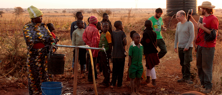
Studies of various types of aquifers, from porous ones of alluvial plains to those in mountain rock, up to complex hydrogeological conditions such as multi-aquifer aquifers and the complex transport dynamics of polluting compounds. Such situations require an adequate planning of sampling strategies to verify the hydrodynamic relationships between the two aquifers, and to locate any sources of contamination. In fact, the protection of the quality and quantity of surface water and groundwater, the protection of the environment and ecosystems related to water bodies are among the main objectives pursued.
Numerical modeling
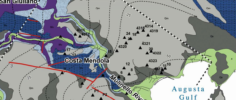
Flow models are applied for local and regional studies of the field of motion, changes in hydraulic load caused by changes in flow rates or recharge; load variations near well fields, in groundwater containment systems (dewatering), injection wells and for studies on the interaction between groundwater and surface water. Models for solute transport are currently applied for studies on salt intrusion, leachate movements in landfills, contamination plumes in areas subject to reclamation, radionuclide movement, pesticides in cultivated fields and other types of groundwater pollution.
Pumping tests
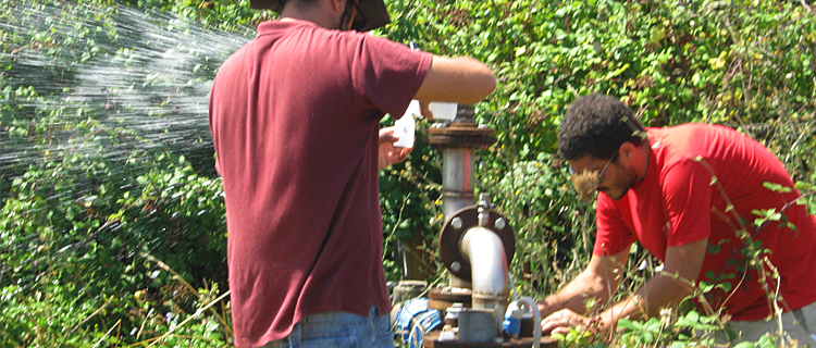
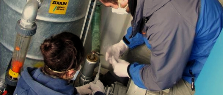
The acquisition of data by means of underground and in-river flow tests, measures of the chemical-physical characteristics of water, sampling and interpretation of chemical and isotopic analysis of water, and, therefore, of increasingly in-depth knowledge on underground aquifers are indispensable information for a correct planning of water resources management, an asset that is currently subject to qualitative and quantitative impoverishment processes.
Groundwater vulnerability and impact assessments
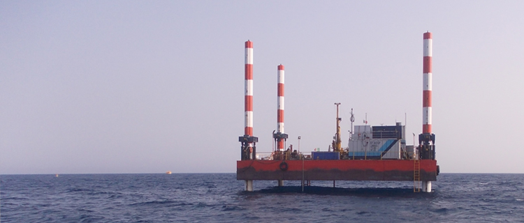
Environmental studies are carried out, in particular in support of research and production of hydrocarbons. The services offered include: environmental reports (Screening) and preliminary impact assessments, related to the exploration and production of hydrocarbons, for permits and permits onshore and offshore, awaiting conferment; environmental impact studies (SIA), on the ground: for applications awaiting conferral that contain protected natural areas (SIC, ZCS and others), for drilling stations, traces of seismic lines, traces of gas pipelines and oil pipelines; at sea: for drilling and production platforms, laying of subsea pipelines, technological systems (regasifiers).
Non-technical summary and assistance during the evaluation procedure is also included. The baseline survey can be performed if and for how long it is needed.
The activity refers specifically to national and regional legislation.È inclusa inoltre la sintesi non tecnica e l’assistenza nel corso della procedura di valutazione. Il baseline survey può venire effettuato se e per quanto serve. L’attività fa riferimento specifico alla legislazione nazionale e regionale.
Environmental remediation
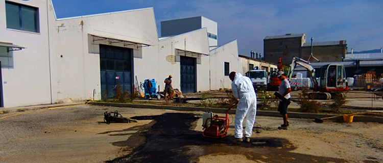
In the reclamation scenario, wastewater treatment systems that are very expensive and overgrown are used predominantly. In recent years the Laboratory is occupied with various methods to implement the interventions and monitoring, from the classical to sustainable costs, which does not alter the natural conditions of water drain buried, thus avoiding interfering with the production activities present in the area, and favoring the existing water points.
Environmental Geology
Environmental investigations are carried out on contaminated sites, planning and monitoring all the environmental matrices, and developing and designing reclamation systems for even unconventional groundwater. In addition to the most commonly used methods for the depollution of groundwater, in fact, the CGT Group staff studies methodologies that provide efficient systems at sustainable costs, which do not alter the qualitative characteristics of groundwater and their natural underground drainage conditions, thus avoiding to interfere with the production activities in the area, and favoring the existing water points.
Geostatistics
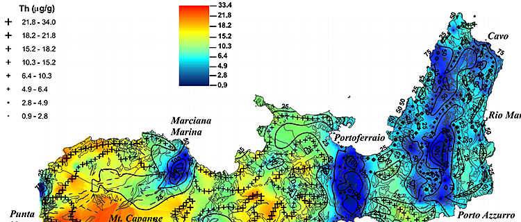
Geostatistics was born in the field of soil-related sciences such as pedology and agronomy although in the 60s of the last century it was brought to the fore as a methodology applied to the mining industry. Geostatistical applications in the environmental and territorial field are very common today. The staff makes use of the most advanced statistical-spatial calculation tools to make estimates and simulations of continuous surfaces or continuous volumes starting from samplings positioned at certain points of space, within various research projects.