Archaeological monitoring
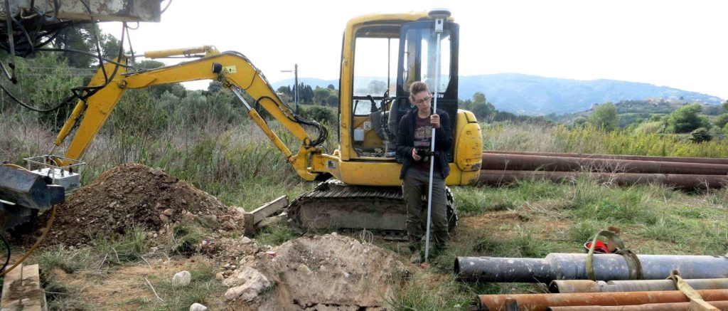
Our specialized archaeologists carry out Archaeological monitoring activities: management of relations with the competent Superintendency and coordination with the Archaeological Officer of the area, on-site assistance to contractors during earthmoving activities for public and private works, identification of any archaeological evidence, GPS survey, graphic and photographic documentation, daily diary and final report delivered to the Superintendency following national guidelines.
Archaeological evaluation
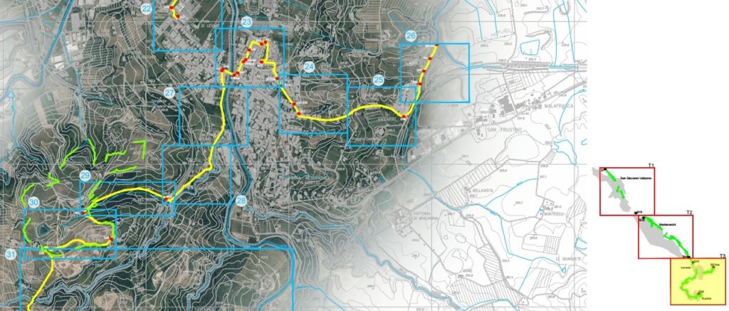
We are registered at the MiBACT (Ministry of Cultural Heritage and Tourism) with number 3232 in the list of operators allowed to perform the archaeological evaluation document in the preliminary public project. Thanks to the skills of our qualified archaeologists and geologists, all preliminary investigations are developed independently: geological and geomorphological study of the areas, photointerpretation, archaeological reconnaissance of the area and study of archive and bibliographic data. We analyze the collected data by GIS environment for the creation of maps of archaeological evidence, relative and absolute risk in order to evaluate the archaeological impact and to obtain a smart design of the territory.
Goephysical applications
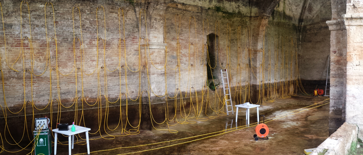
By the skills of our geophysicists, we offer non-invasive geophysical investigations to support archaeological research and diagnostics of cultural and monumental heritage. We carry out surveys with geoelectric and georadar methods in order to identify anomalies, infiltrations, buried plans and topographical positioning of the archaeological evidence. We process, interpret and return the data acquired in the GIS and CAD environment with georeferencing of data (2D and 3D).
Geomatic applications
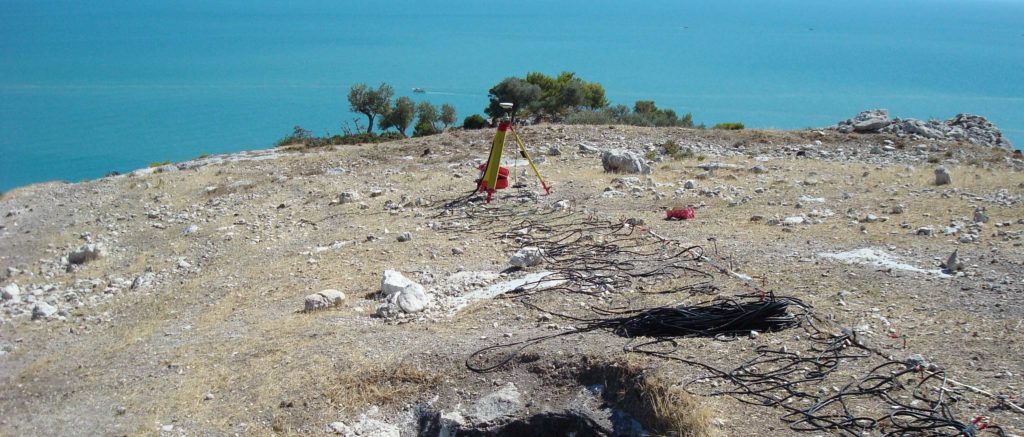
We develop structural monitoring activities of Cultural and Architectural Heritage, 2D and 3D surveys of archaeological sites and Cultural Heritage, with the use of Laser Scanner, Total Station, GPS and SAPR (drone). We are also able to carry out aerophotogrammetric surveys for the production of Digital Terrain Models (DTM), identification of archaeological sites and high resolution surveys of vertical walls with difficult accessibility.